Master solo hiking safety with our guide on satellite messengers. Learn technical protocols for emergency SOS, tracking, and redundant communication.
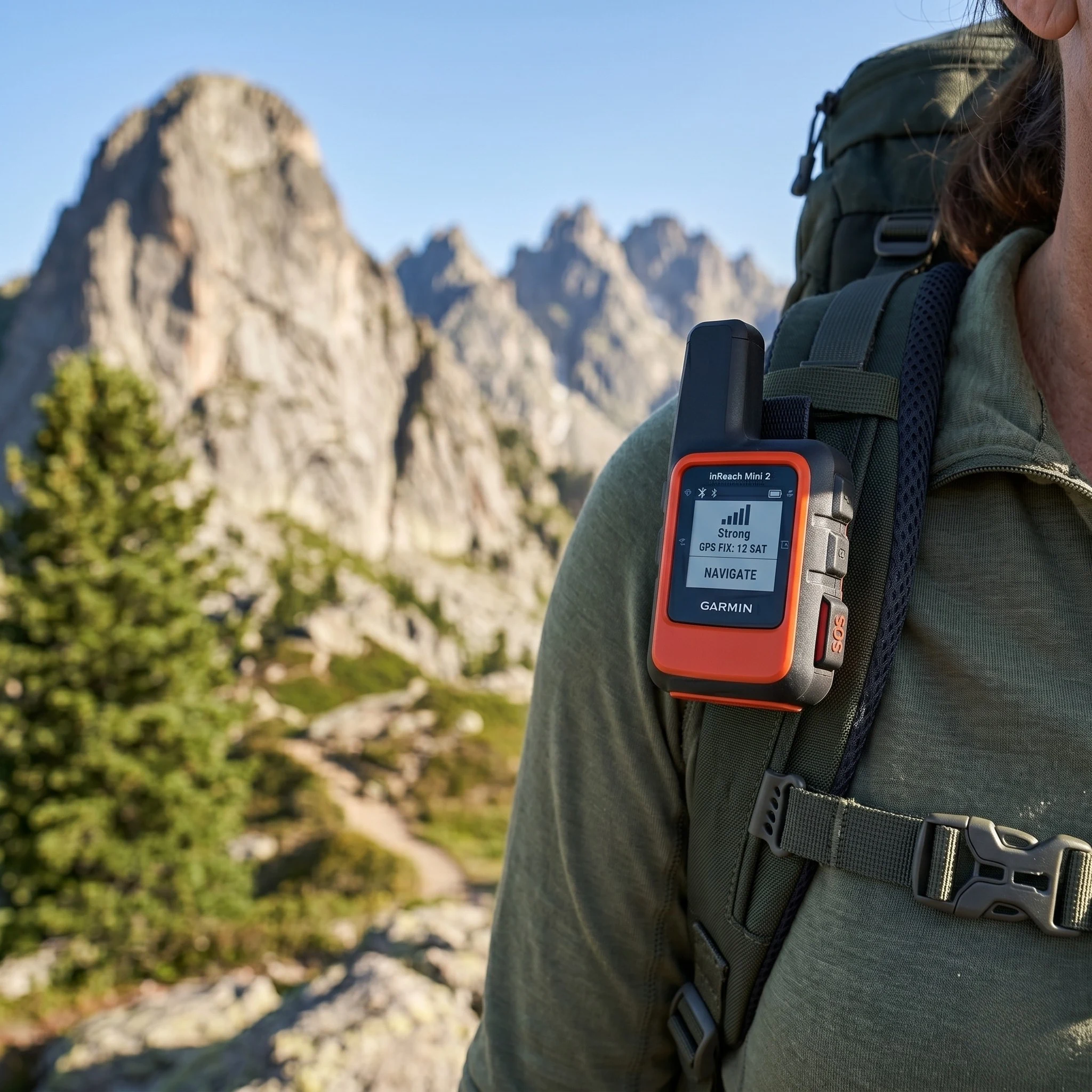
Table of Contents
Introduction: The Mechanical Requirement for Remote Communication
Utilizing satellite messengers is a technical requirement for any individual engaging in high-stakes solo wilderness travel. In remote backcountry environments, standard cellular infrastructure frequently fails due to terrain shadowing and lack of tower density. For those transitioning into Solo Bikepacking Safety or extended mountain trekking, the ability to transmit data outside of traditional networks is a non-negotiable safety protocol. A satellite messenger serves as a dedicated digital lifeline, facilitating two-way communication, real-time tracking, and emergency rescue coordination.
The primary objective of this hardware is the prevention of isolation during a crisis. Unlike standard GPS units used for Off-Road Navigation, messengers focus on the transmission of short-burst data packets to global satellite constellations. This guide provides a disciplined technical analysis of how to select, configure, and operate these devices to maintain a positive safety balance. Mastering these systems is as critical for the solo hiker as the physical conditioning found in a Bikepacking Training Plan.
1. Understanding the Physics of Satellite Connectivity
To effectively use satellite messengers, the hiker must understand the mechanical limitations of the signal path. Most modern devices, such as those from Garmin and Zoleo, utilize the Iridium Satellite Network, a constellation of 66 low-earth orbit (LEO) satellites. This provides 100% global coverage, including the poles.
Line-of-Sight Requirements
A satellite signal requires a clear line-of-sight to the sky. Dense forest canopies, narrow slot canyons, and high-angle granite walls can block or “shadow” the signal. The hiker must recognize that messages may not be sent instantly; the device must wait for a satellite to pass overhead. This understanding is vital for maintaining a calm Bikepacking Mindset when a message status remains “Pending” during a storm.
The Role of Antenna Orientation
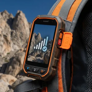
Device placement is a primary operational factor. For optimal performance, the antenna should be oriented toward the zenith (directly upward). Attaching the device to the top of a pack or a shoulder strap is superior to placing it inside a pocket or a Bikepacking Bag.
2. Technical Comparison: Garmin inReach vs. Zoleo vs. Spot
Selecting from available satellite messengers requires an evaluation of the device’s feature set relative to the hiker’s specific needs for Solo Safety.
Garmin inReach Mini 2 (The Industry Standard)
Key Feature
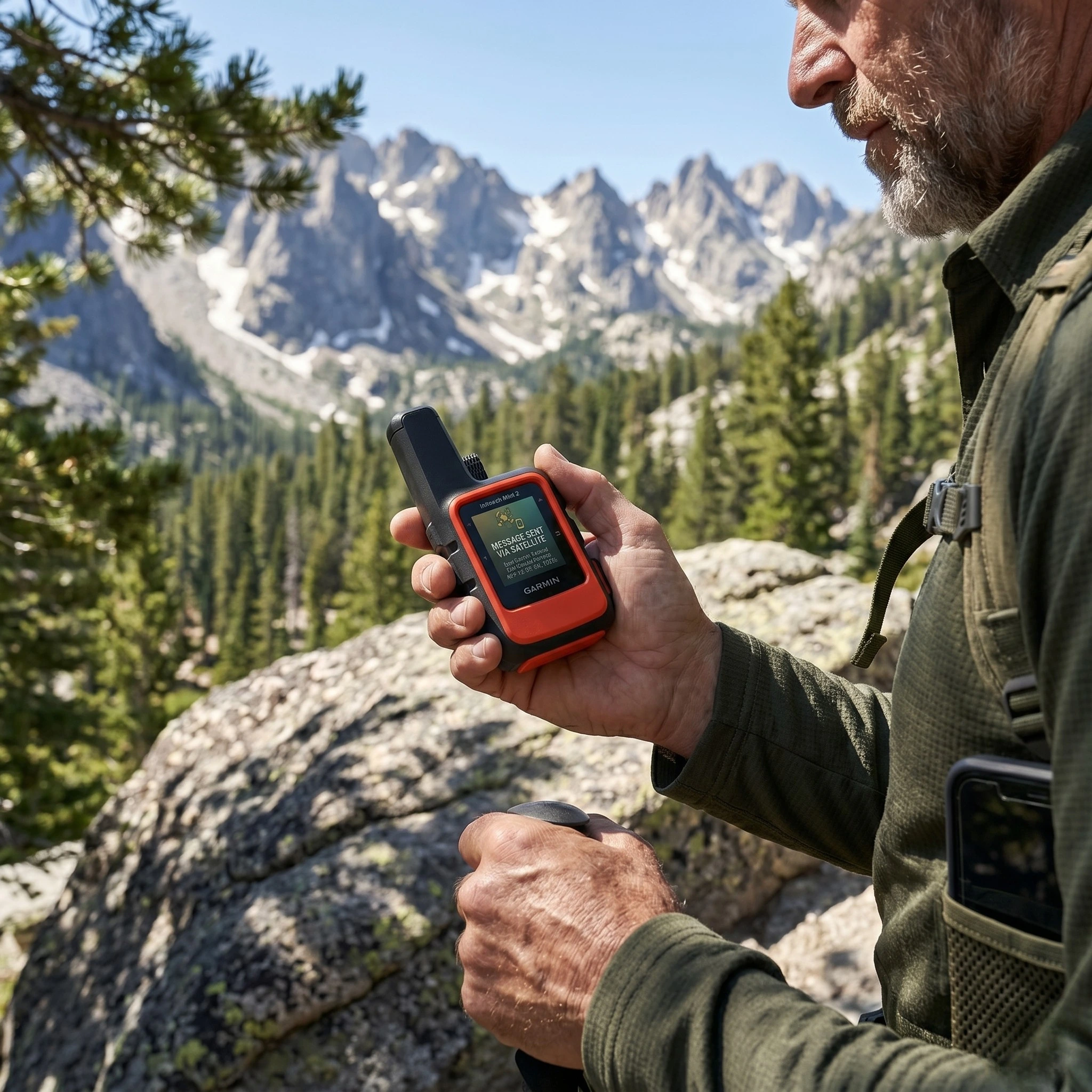
Pros
Cons
Zoleo Satellite Communicator (The Messaging Specialist)
Key Feature
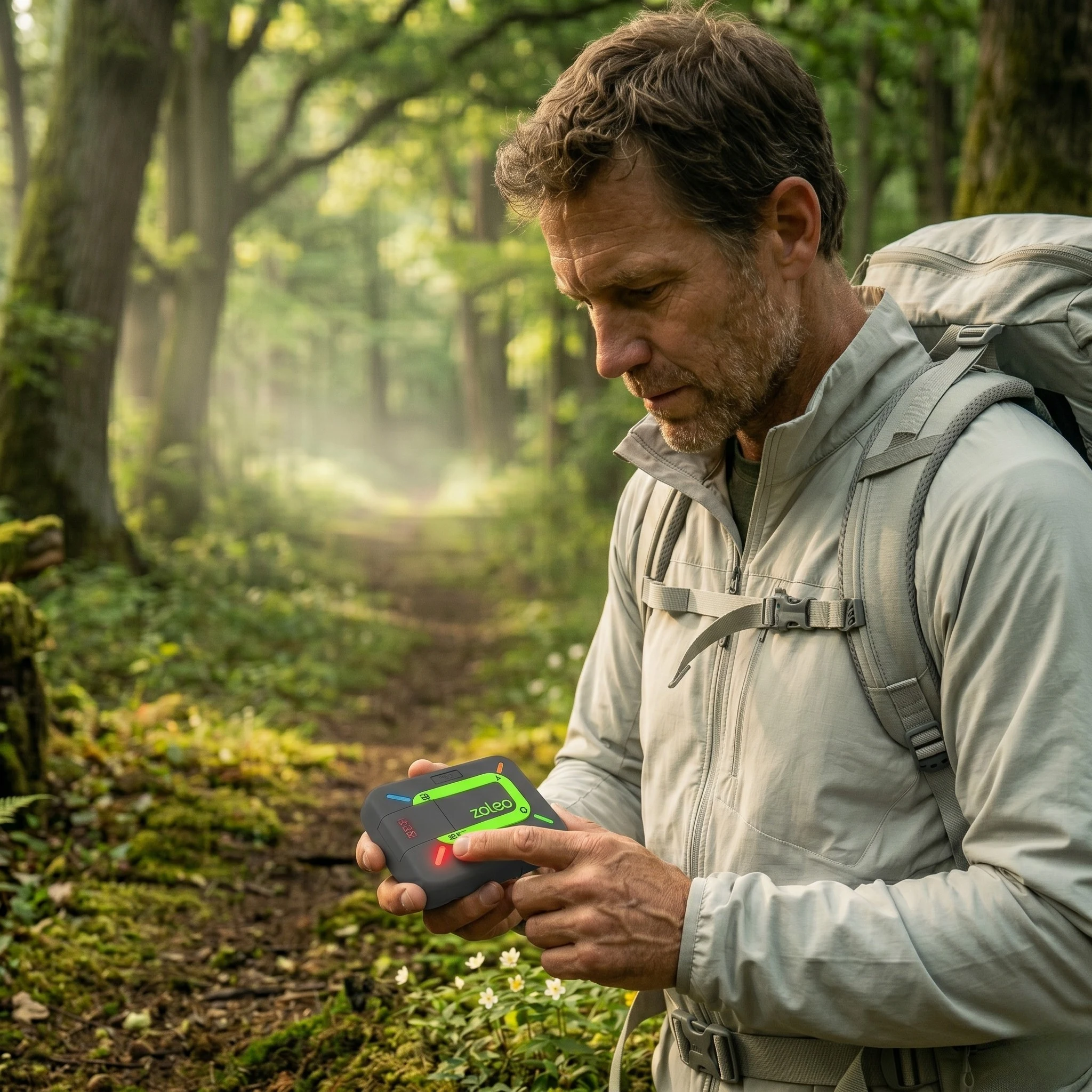
Pros
Cons
Spot Gen4 (The One-Way Legacy)
Key Feature
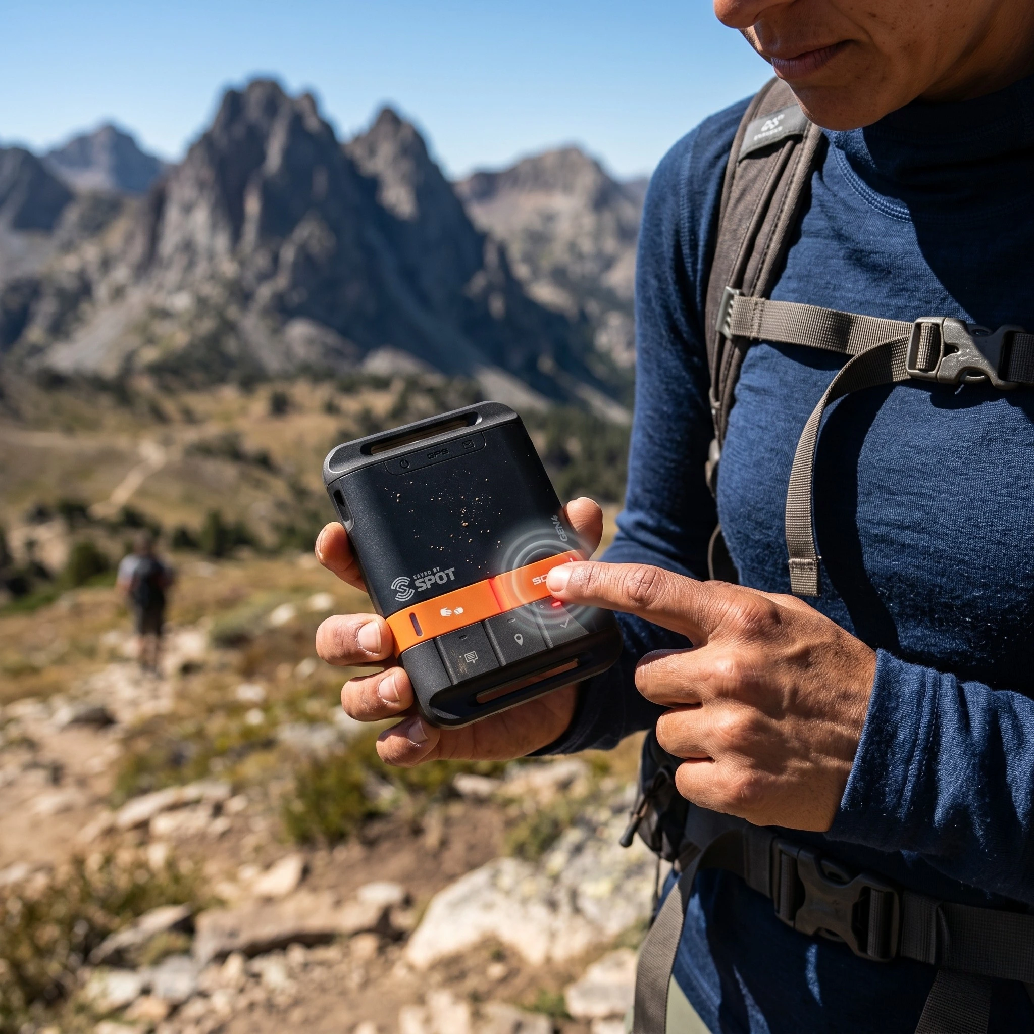
Pros
Cons
3. The “Flight Plan” and Tracking Protocol
A successful solo mission relies on the “Flight Plan” protocol—a pre-departure agreement between the hiker and a terrestrial emergency contact. Satellite messengers facilitate this by providing real-time tracking points.
Configuring Tracking Intervals
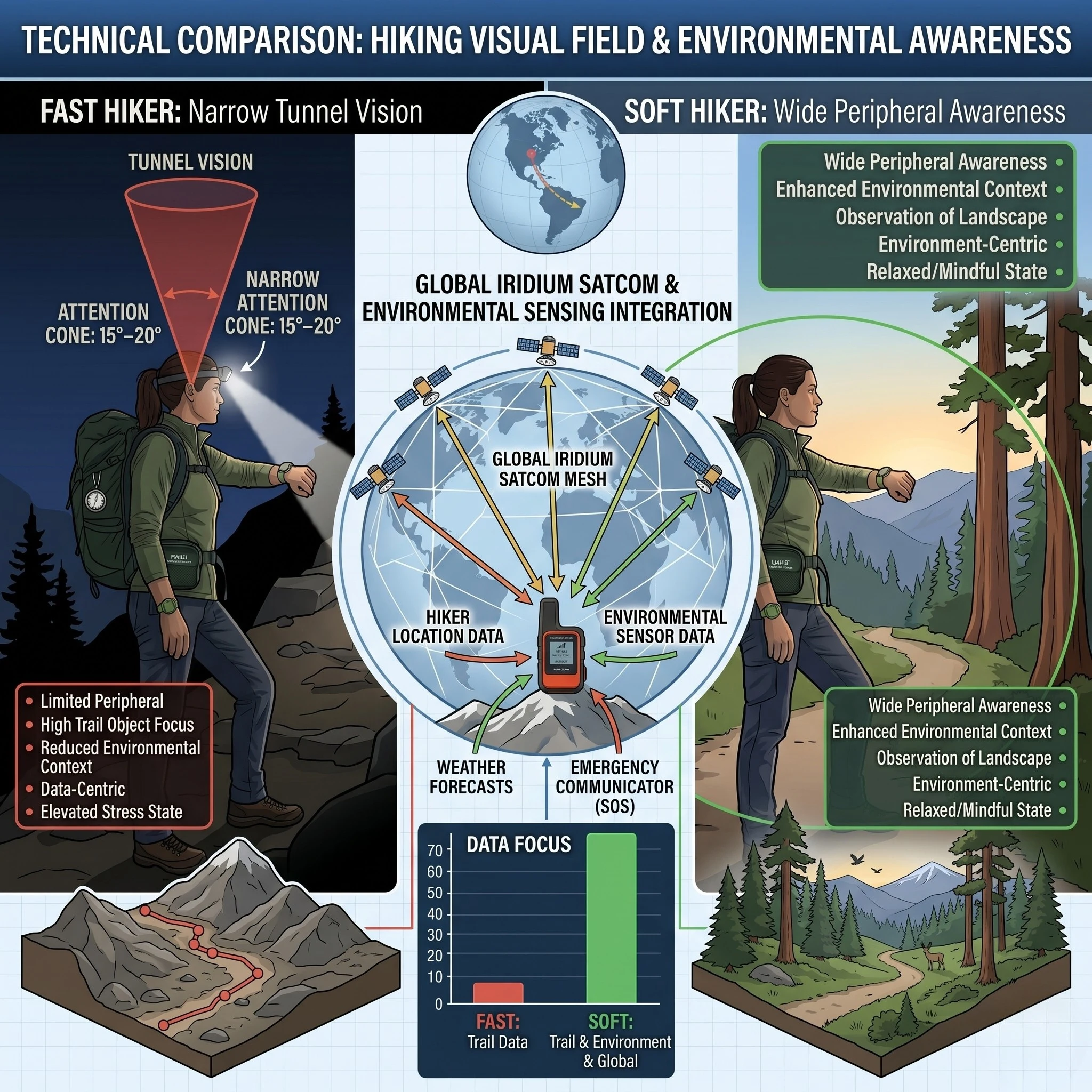
The hiker should set the device to transmit a GPS coordinate every 10 to 30 minutes. This creates a “breadcrumb” path on a private web-map. In the event of a total communication failure, search and rescue (SAR) can utilize the last known coordinate to narrow the search area. This proactive data logging is a core component of Soft Hiking safety for those moving at a slower pace.
Check-In Message Cadence
Standard procedure involves sending a “Starting” message, a “Mid-day Status” message, and a “Camp Set” message. These preset messages do not count against data limits on most plans. Consistent check-ins prevent “family anxiety,” which often leads to premature and unnecessary SAR activations.
4. SOS Management and Emergency Coordination
The SOS button is the most critical mechanical component of all satellite messengers. When activated, the device initiates a distress signal to a private monitoring center, such as the IERCC (International Emergency Response Coordination Center).
When to Trigger the SOS
The decision to trigger an SOS is a technical assessment of risk. It must be reserved for life-threatening situations where the individual cannot self-evacuate. This includes major trauma, severe Heat Hacking failures, or total disorientation in extreme weather. According to the National Park Service, SAR operations are expensive and dangerous; the hiker must first attempt all self-rescue protocols.
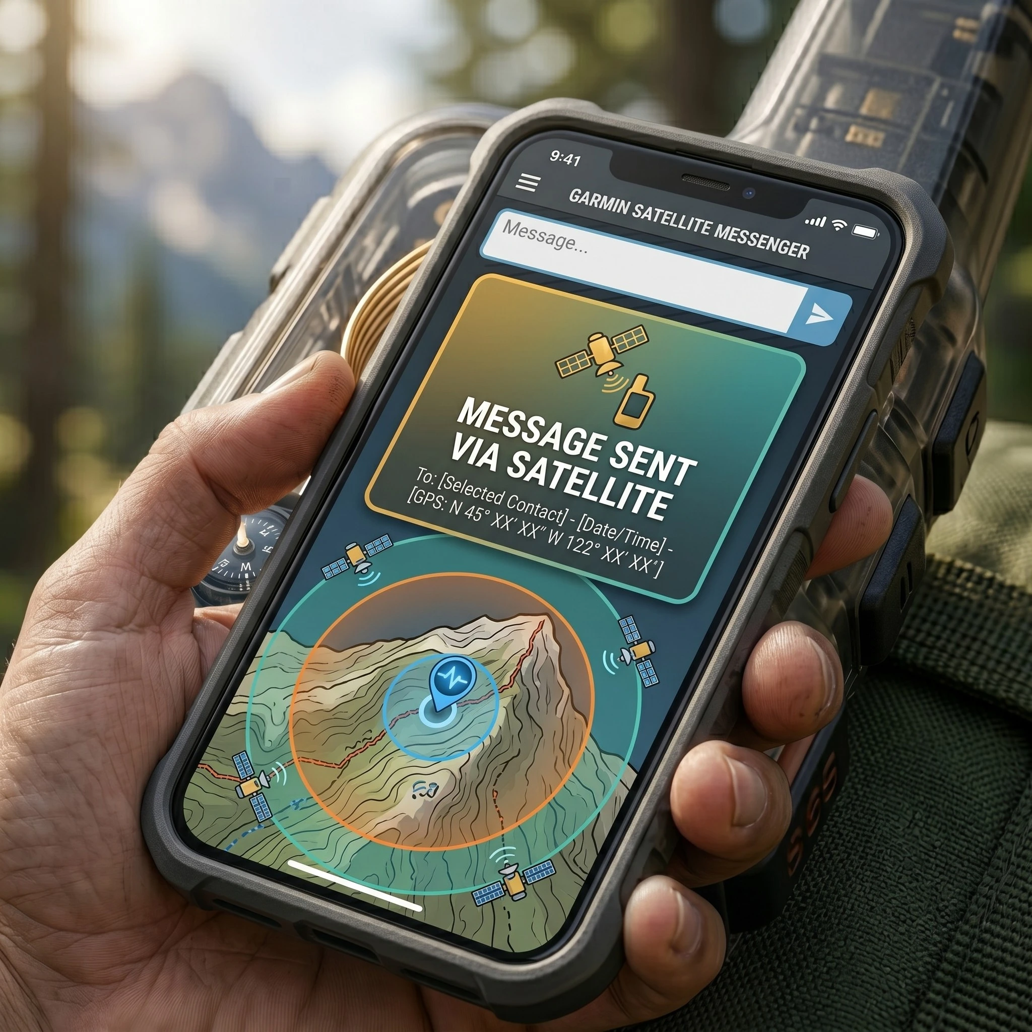
The Two-Way Communication Advantage
One of the primary benefits of two-way satellite messengers is the ability to communicate the nature of the emergency. The hiker can specify if they need a helicopter, a technical ground team, or simple advice for a non-life-threatening mechanical failure. This allows SAR teams to deploy the correct resources, increasing efficiency and safety for everyone involved.
5. Logistical Readiness: Battery and Firmware Management
A satellite messenger is only effective if it is operational. The individual must implement a “Readiness Checklist” before every trip, similar to the Bikepacking Maintenance routines used for hardware.
- Firmware Updates: Satellite constellations and internal software require frequent synchronization. The hiker should check for updates via a desktop application (e.g., Garmin Express) at least 48 hours before departure.
- Battery Cycle Management: Lithium-ion batteries lose capacity in extreme cold. Keep the device in an internal pocket or close to the body during Wet Weather or winter missions to preserve thermal stability.
- Redundant Power: Always carry a high-quality Portable Power Bank to ensure the messenger can be recharged in the field.
6. Subscription Models and Data Limits
Operating satellite messengers requires an active service plan. These plans vary based on the frequency of messages and the depth of the tracking data.
Seasonal vs. Annual Plans
For hikers who only venture out during summer months, “Freedom” or seasonal plans allow the user to suspend service during the off-season. This aligns with the Budget Setup strategies of Maive Verse. However, a reactivation fee is usually required.
Data Overages and Safety
The hiker must monitor their message count. While preset messages are often unlimited, custom two-way texts can incur significant costs if the limit is exceeded. For emergency situations, SOS communication is always prioritized and handled regardless of the current plan’s data status. For detailed pricing structures, refer to the Garmin Subscription Guide.
7. Navigational Integration and Map Syncing
Advanced satellite messengers integrate with smartphone mapping applications via Bluetooth. This provides a high-resolution interface for Backcountry Navigation.
Topographic Overlay Efficiency
Using an app like Garmin Explore or Earthmate allows the hiker to view their satellite-derived position on a high-resolution topographic map. This is superior to the small, low-resolution screens found on the devices themselves. It facilitates precise line selection in Rugged Terrain.
The Compass Redundancy
Even with a satellite messenger, the individual should maintain a basic knowledge of analog tools. If the device’s digital compass becomes decalibrated due to magnetic interference, a traditional magnetic compass remains the ultimate backup. This tiered approach to safety is a hallmark of the Maive Verse Mentor philosophy.
8. Environmental Ethics and Signaling
In accordance with Leave No Trace Principles, the use of digital signaling is preferred over traditional physical signals like fire or rock cairns.
- Zero Impact: A satellite SOS signal leaves no trace on the environment, unlike a signal fire which can cause wildfires.
- Social Responsibility: Use the messenger to report trail hazards or medical emergencies encountered by other hikers. This social stewardship is emphasized by the NOLS Wilderness Leadership standards.
- Sound Discipline: Keep device notification sounds low or on vibrate to preserve the Bikepacking Mindset of solitude for yourself and others.
Conclusion: The Professional Standard for Solo Hiking
Mastering the use of satellite messengers transforms the solo hiking experience from a risky endeavor into a calculated, self-reliant adventure. By prioritizing line-of-sight connectivity (Section 1), implementing a rigorous tracking protocol (Section 3), and understanding SOS coordination (Section 4), any individual can explore the backcountry with confidence. The success of a mission is not measured by the speed of the ascent, but by the level of safety and technical readiness maintained throughout the journey.
Remember that technology is a tool, not a replacement for Technical Skills. Keep your Physical Conditioning high, your equipment maintained, and your emergency contacts informed. As you progress from local trails to remote wilderness loops, your ability to manage your communication systems will become your most valuable psychological asset.
The wilderness is waiting, and with the right digital lifeline, you are ready to conquer it responsibly. Treat the environment with respect, follow the Responsible Outdoor Code, and enjoy the unique liberation of solo travel. The transition from a recreational walker to a seasoned backcountry navigator is a path paved with preparation. Step out with a plan, respect your limits, and embrace the unparalleled freedom of the unpaved world.
Discover more from Maive Verse
Subscribe to get the latest posts sent to your email.