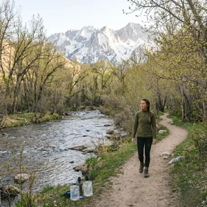

Master the transition to spring with our best low-elevation hikes guide. Learn 5 rules to predict snowmelt, read topography, and find dry trails.
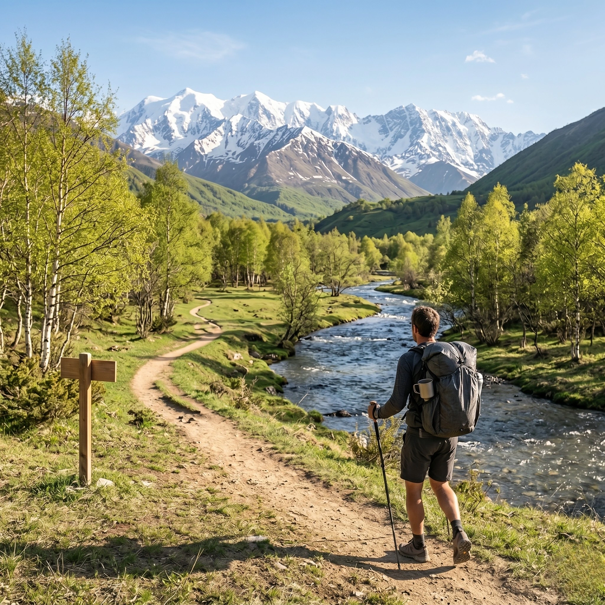
Table of Contents
The Thermal Realities of Spring Trails
Identifying the best low-elevation hikes is a primary requirement for hikers transitioning from winter snowsports to spring trail travel. During the transitional season, high-altitude mountain corridors remain locked in deep snowpack, presenting avalanche hazards and navigation challenges. By shifting focus toward lower-elevation drainage basins and river valleys, adventurers can enjoy dry, accessible terrain while high-elevation trails melt out. This physical adaptation is a key skill taught in our Trail Elevation Prep Guide.
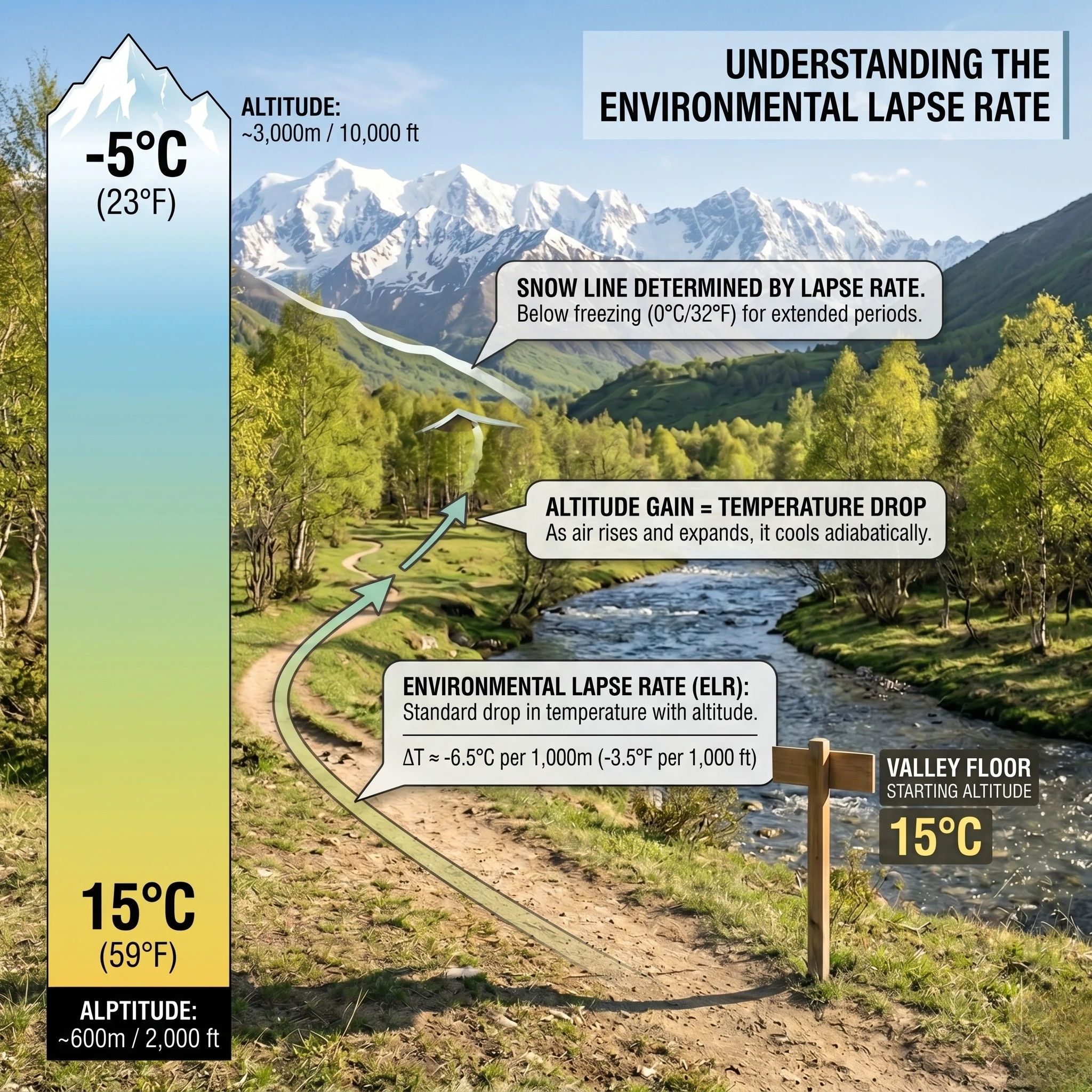
The primary meteorological mechanism governing snow presence is the environmental lapse rate. As elevation increases, atmospheric pressure drops, causing the temperature to decrease. This thermal decay can be modeled by the linear equation:$$T(z) = T_0 – \Gamma \cdot z$$
Where:
- $T(z)$ is the ambient temperature at elevation $z$.
- $T_0$ is the temperature at sea level (or a base weather station).
- $\Gamma$ is the environmental lapse rate, averaging approximately $6.5^\circ\text{C}$ per kilometer ($3.57^\circ\text{F}$ per $1,000\text{ feet}$).
- $z$ is the target altitude.
Understanding this formula allows the traveler to predict the exact boundary where warm valley air transitions into freezing mountain terrain. Shifting operations to lower values of $z$ ensures that the trail remains warm and dry. This methodology is highly valued in the Soft Hiking Guide philosophy, where maintaining physical comfort and accessibility is prioritized over peak-bagging.
Topographic Mapping Protocols
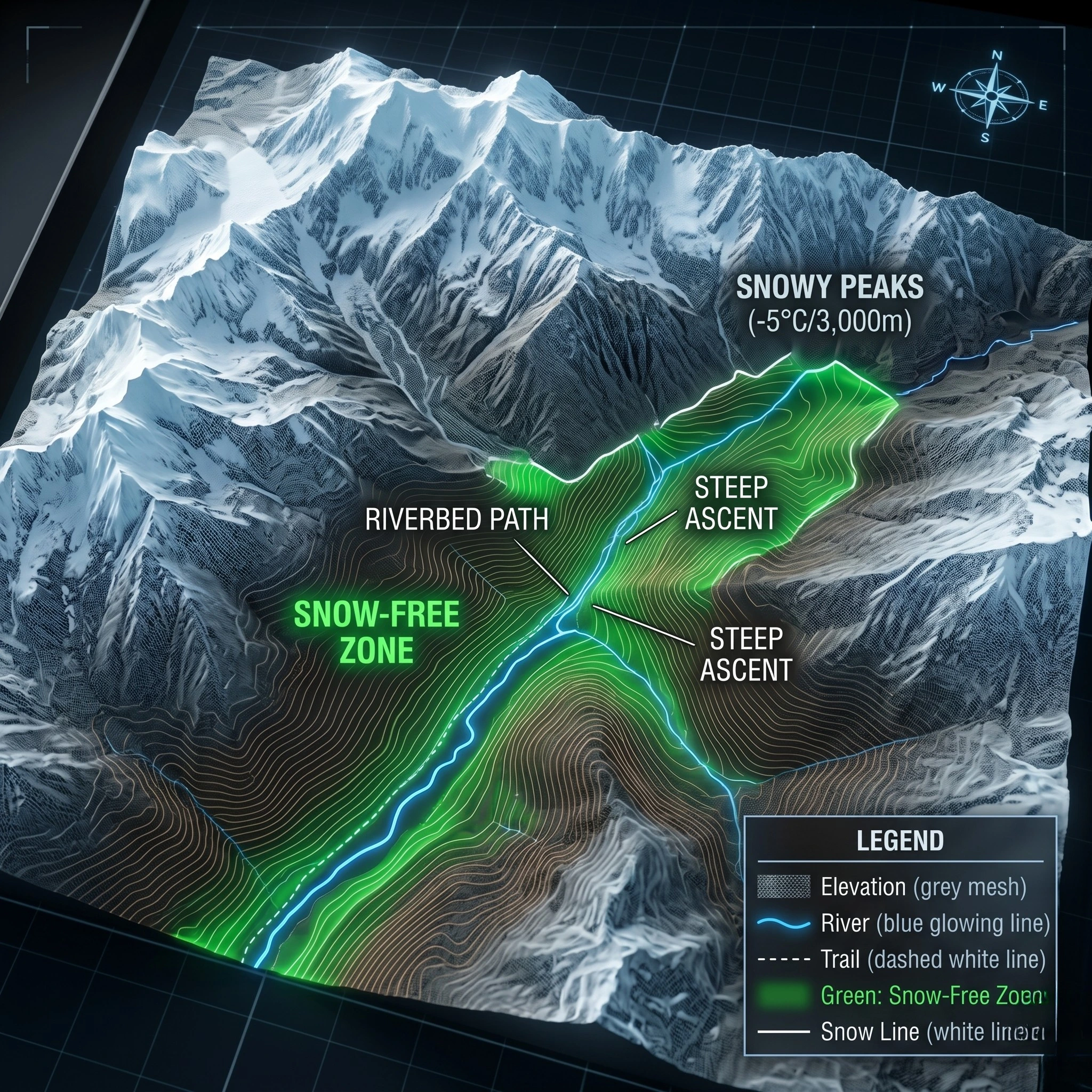
Determining which valley corridors are free of snow requires a disciplined analysis of topographic maps. The individual should utilize high-resolution USGS Topography maps to identify trail systems situated below the regional spring snowline.
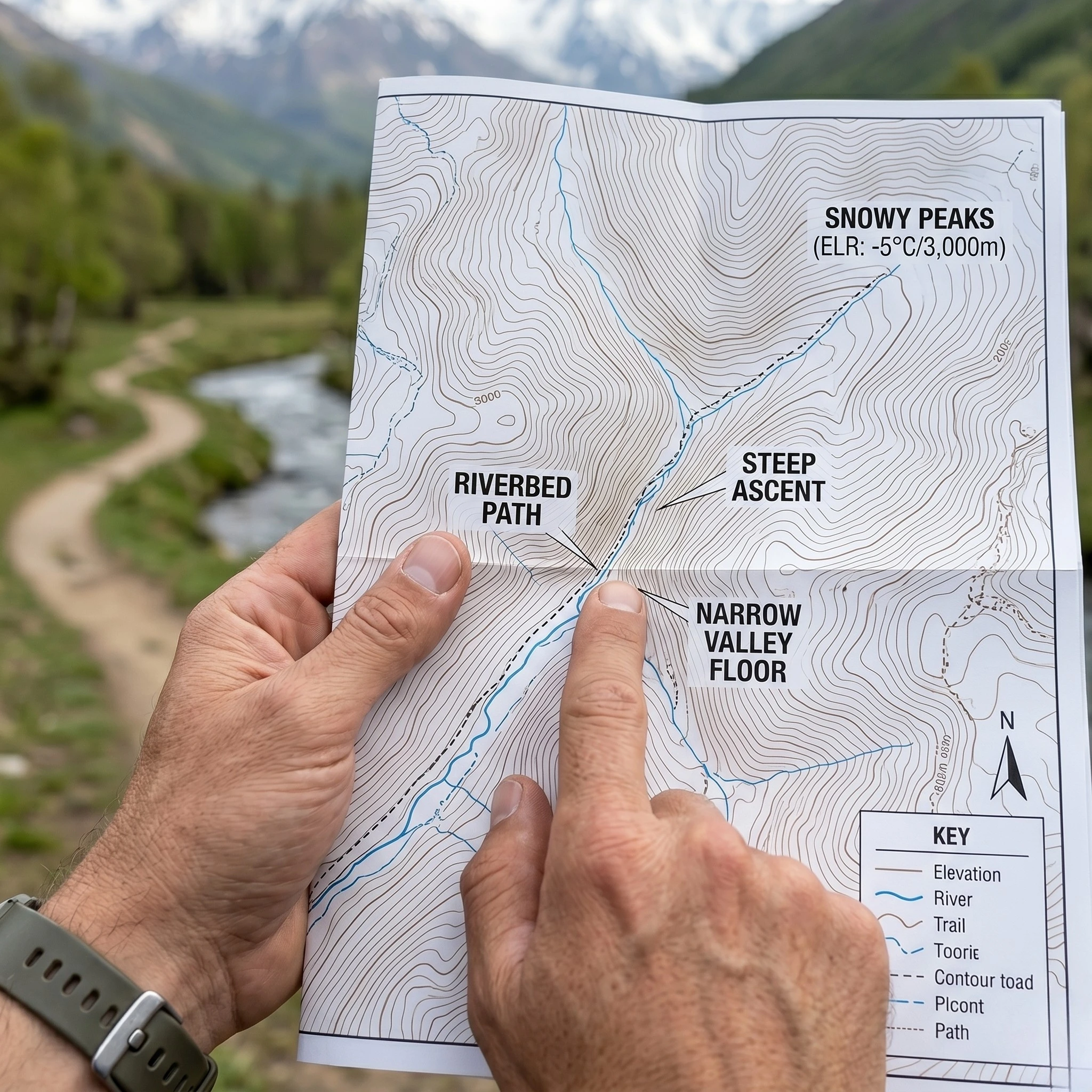
When evaluating terrain, one must analyze contour lines. Closely spaced lines indicate steep, shaded ravines where snow can persist late into the summer. Conversely, widely spaced lines indicate flat, open valley floors that receive maximum solar exposure. In early spring, river-bottom trails and coastal headlands consistently offer the most reliable dry surfaces. Integrating this topographic data with active satellite imagery, as detailed in our Trail Weather Prediction Guide, allows for real-time route verification.
Aspect, Slope, and Vegetation Indicators
Once elevation is established, the hiker must evaluate the “aspect”—the compass direction that a slope faces. Aspect dictates the angle of solar incidence and, consequently, the rate of snowmelt.
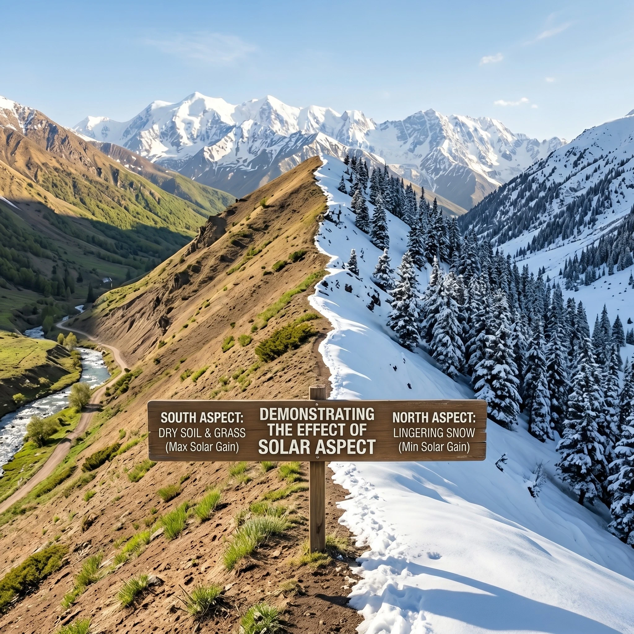
- South-Facing Slopes: In the Northern Hemisphere, south-facing slopes receive the most direct sunlight throughout the day. These slopes melt out weeks before adjacent valleys, making them ideal targets for early-season travel.
- North-Facing Slopes: These slopes remain in shadow for extended periods. Even at low elevations, dense forests on north-facing aspects can harbor deep snow and ice.
- Vegetation Indicators: Deciduous forests (oaks, maples) generally indicate warmer, lower-elevation soils. If a trail enters dense evergreen forests (pines, firs), the ground temperature is typically lower, increasing the probability of lingering ice.
Before departing, the individual must ensure their gear is prepared for variable mud and wet soil. Reviewing our Bikepacking for Beginners Guide provides excellent crossover tips on managing water protection and trail mechanics.
Conclusion: The Transition to High-Value Spring Travel
Mastering the selection of the best low-elevation hikes is a vital skill for year-round trail engagement. By understanding the thermodynamic lapse rate and analyzing the aspect of local slopes, hikers can find dry, stable trails while the high peaks remain inaccessible. This proactive approach to planning prevents the frustration of encountering unexpected winter conditions and ensures that every outing remains safe and productive.
Remember to respect the delicate spring environment. Wet soils are highly susceptible to erosion; hikers must always walk through mud patches rather than around them to prevent widening the trail corridor, adhering strictly to Leave No Trace Principles. Keep your training consistent and your ecological footprint low. The transition from winter to spring is a path best navigated with preparation and a deep respect for the natural cycles of the mountain.
Discover more from Maive Verse
Subscribe to get the latest posts sent to your email.